
Drone Mapping & Monitoring for Smarter Construction
Our services deliver high-accuracy maps, progress visuals, and as-built documentation that help you stay ahead at every stage.
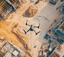
Get clear, high-resolution maps and orthomosaics to support planning, overlays, and documentation—no ground crew required.
Our professional drone services deliver high-accuracy maps, progress visuals, and as-built documentation that help you stay ahead at every stage—from pre-construction to project closeout.
Forget outdated site photos and slow survey reports. With cutting-edge drone imaging, we provide real-time visual data that improves communication, boosts efficiency, and supports smarter decision-making across your entire project team.
Visualize terrain, access, and layout challenges before construction starts. Make decisions with confidence. Track milestones, site changes, and team coordination with scheduled aerial imagery and video updates.
Our professional drone services deliver high-accuracy maps, progress visuals, and as-built documentation that help you stay ahead at every stage—from pre-construction to project closeout.
Forget outdated site photos and slow survey reports. With cutting-edge drone imaging, we provide real-time visual data that improves communication, boosts efficiency, and supports smarter decision-making across your entire project team.
Confirm that your finished work matches the plan. Capture accurate, defensible visual records for closeout and compliance.
Our professional drone services deliver high-accuracy maps, progress visuals, and as-built documentation that help you stay ahead at every stage—from pre-construction to project closeout.
Forget outdated site photos and slow survey reports. With cutting-edge drone imaging, we provide real-time visual data that improves communication, boosts efficiency, and supports smarter decision-making across your entire project team.

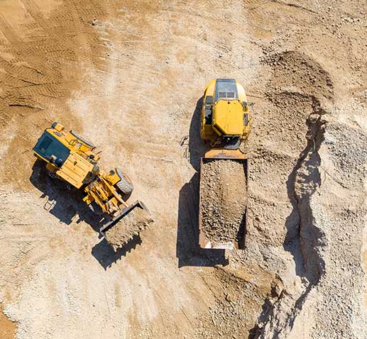
Get clear, high-resolution maps and orthomosaics to support planning, overlays, and documentation—no ground crew required. With drone-based aerial imaging, you can capture every detail of your site from above, producing sharp, accurate maps that are ready for integration with CAD files, GIS platforms, and project management tools. Orthomosaics provide a precise, scalable view of your terrain and structures, allowing you to overlay design plans, measure distances and volumes, and document progress with unmatched clarity. What once required days of manual surveying can now be accomplished in hours, with higher accuracy and zero disruption on the ground.
Visualize terrain, access, and layout challenges before construction starts. Aerial imagery gives you a bird’s-eye perspective of the entire site, making it easy to identify potential obstacles like grading issues, drainage concerns, or logistical bottlenecks before they become costly problems. Make decisions with confidence by comparing proposed designs against real-world conditions, ensuring that planning is grounded in accurate, up-to-date visuals. Track milestones, site changes, and team coordination with scheduled drone flights that provide consistent aerial imagery and video updates. This creates a verifiable record of progress, supports clear communication among stakeholders, and helps teams stay aligned from groundbreaking to project completion.

Confirm that your finished work matches the plan. High-resolution drone imagery allows you to compare as-built conditions directly against design documents, ensuring accuracy down to the smallest detail. By overlaying plans with current aerial maps, you can quickly verify that grading, layout, and structural placement meet specifications. Capture accurate, defensible visual records for closeout and compliance. These records provide a clear, time-stamped audit trail that satisfies owner requirements, supports regulatory compliance, and protects your team from disputes or claims. Instead of relying on scattered photos or manual notes, you’ll have a comprehensive visual archive that stands as verifiable proof of work completed.
Our services deliver high-accuracy maps, progress visuals, and as-built documentation that help you stay ahead at every stage.